
Where The Heck Am I?

In my Literacy for Life current events class today, I plan to spend some time talking about the geography of the state of Virginia. Most of the learners who attend my class have been in the US for less than a year, and they are generally too busy trying to work and take English classes to have time to study where they live. Part of what I do is introduce them to their surroundings and facilitate their assimilation.
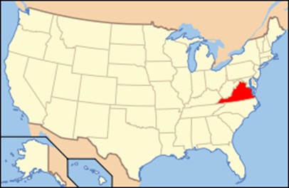
First I talk about the overall map of Virginia. Here’s the map I’ll use:
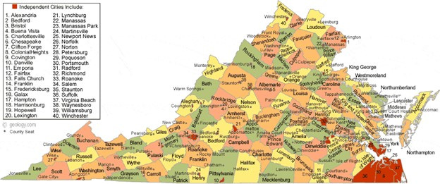
This lets me focus a little on the fact that Virginia has counties as well as independent cities.
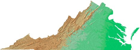
Next, I look at the landforms in Virginia, using a topographical map. We live in the deep green area on the east side of this map. The first range of mountains in the west is the Blue Ridge, and the second range is the Appalachian Mountains. In between these ranges is the Shenandoah Valley, sometimes referred to as the “Great Valley” of Virginia. Virginians simply refer to it as The Valley.
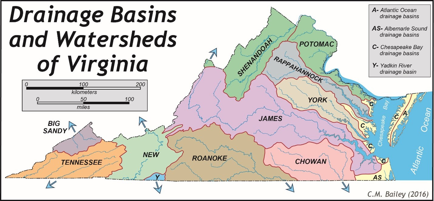
The river systems of Virginia were critical to the exploration, settlement, growth, and development of the state. Here are the areas drained by the major rivers in Virginia :
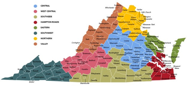
Then we look at the regions of Virginia:
Next, we focus in on Eastern Virginia – the peninsulas formed by the rivers that flow into the Chesapeake Bay:
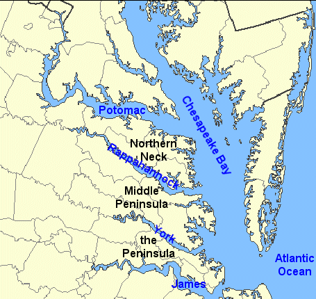
We live on “The Peninsula,” between the James and York Rivers. The Middle Peninsula is between the York and Rappahannock Rivers, and the Northern Neck is between the Potomac and Rappahannock Rivers. The Peninsula and the Northern Neck were areas of early settlement and development in Virginia. Some of the most famous families in Virginia history – the Washingtons, Carters, Lees, Masons, and so forth – lived on the Northern Neck. Other famous families – the Randolphs, Tylers, Harrisons, Byrds, and so forth – lived along the James River on the Peninsula.
The river systems were critical to Virginia’s economy. Because Virginia was an early home of commercial agriculture – first tobacco, then cotton after the invention of the cotton gin in the 1790s – the little villages that we associate with colonial New England didn’t develop in Virginia. Instead, large plantations encompassing thousands of acres – and hundreds of enslaved persons – spread throughout the area. Each plantation was self-sufficient in many ways – with its own blacksmiths, grain mills, coopers, carpenters, brick makers, stonemasons, wheelwrights, tanners, tailors, butchers, metal workers, and silversmiths.. The plantations were located along the rivers because they conducted their own import/export business; they shipped their cash crop to other colonies as well as to Europe, and imported goods they could not manufacture.
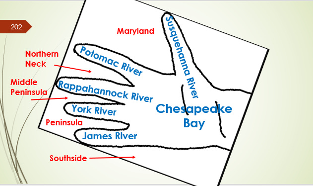
Here’s a graphic I made a few years ago to help my high school students remember the regions of Virginia; I use it with my current learners as well:
One thing I have learned about the people who attend my class is that they try to use what we talk about in class. Two weeks ago, we talked about the variety of hiking and biking trails in our area; last week, one of my students told us about the bike trip he and some of his friends took on one of the trails. Last week, we read a story in our newspaper about a 101-year-old man from Harper’s Ferry, West Virginia, who received his much-belated high school diploma. I showed the students where Harper’s Ferry was on the map and gave them a little history about John Brown’s raid there. I fully expect that someone in the class took a drive to Harper’s Ferry during the past week. We’ll see.
You are a great and creative teacher!