Driving Through History

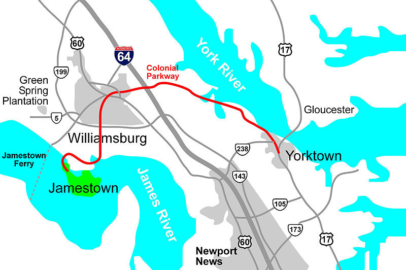
The Colonial Parkway is a scenic roadway that winds its ways through Virginia’s “Historic Triangle” – Jamestown, Williamsburg, and Yorktown. It was built by the National Park Service in the 1930s and 1940s; some of the work was done by workers in the Civilian Conservation Corps (CCC), a New Deal work relief program that provided millions of jobs on environmental projects during the Great Depression.
The three locations that mark this roadway – Jamestown, Williamsburg, and Yorktown – had fallen into disrepair in the years since their prominence in the 18th century. In the early decades of the 20th century, The Association for the Preservation of Virginia Antiquities (APVA) had begun to advocate for the conservation of colonial sites in Virginia, acquiring Jamestown Island and sponsoring visits to the unimproved site. In addition, the APVA organized a Yorktown branch in 1921, to focus efforts on this historic site as well. Williamsburg, the colonial capital of Virginia, had also suffered neglect since the capital was moved to Richmond in 1780; John D. Rockefeller took on the funding of the restoration of this town to the historical site and tourist attraction it is today. To complete this story, Jamestown and Yorktown were adopted by the National Park Service as part of the effort to build the Colonial Parkway. Today, visitors can purchase a joint ticket that provides access to both the Jamestown and Yorktown sites jointly maintained by the National Park Service and the APVA.
Driving on the colonial parkway is a delightful throwback to earlier and less stressful days. Commercial traffic is not allowed on the parkway, and the speed limits vary from 35 to 45 miles per hour. You don’t use the parkway to actually get anywhere. You drive it because it’s a nice drive.
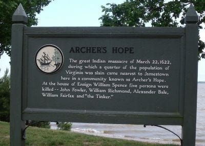
Sites along the parkway are well marked, and include 16 areas where drivers can pull off the road to read the signs and enjoy the vistas. One of our favorite locations is Archers Hope, on the parkway about five miles from Jamestown Island. Here’s the sign that tells us about Archers Hope.
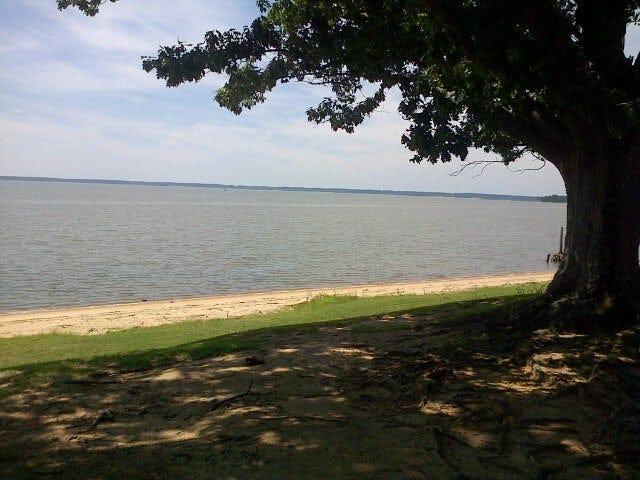
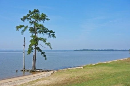
We have picnicked here on unseasonably pleasant days in January, on glorious spring or fall days, on days when it was too hot to be out here but it was okay as long as there was a breeze and we were sitting in the shade. We’ve picnicked here when the breeze was too strong and our food was blown around. We watch the birds here — including gulls, osprey, and eagles. People who study these things report that there are more than 200 pairs of nesting bald eagles along the James Rivers; a dozen of these nesting pairs are on Jamestown Island alone.
We like to sit in here and watch the James River flow by — from its origins in the Shenandoah Valley hundreds of miles to the west (on the right in these pictures) and think of the river traffic over the years. The indigenous people who lived along this river for thousands of years traversed this waterway in small canoes. In the 16th century, Spanish ships sailed these waterways. English ships moved up this river in 1607, bringing the first settlers to Jamestown Island. Other English ships carried slaves upriver to the inland plantations and tobacco downriver from the plantations to the rest of the world. Civil War General George B. McClellan led the 1862 Peninsula Campaign past this site. This was the campaign in which the Union forces attempted (unsuccessfully) to seize Richmond, the capital of the Confederacy (90 miles upstream from this location). In modern times, the Newport News Shipyard (30 miles to the east of this site) created a steady flow of shipping past this location. Now the river traffic consists primarily of pleasure boats and garbage scows.
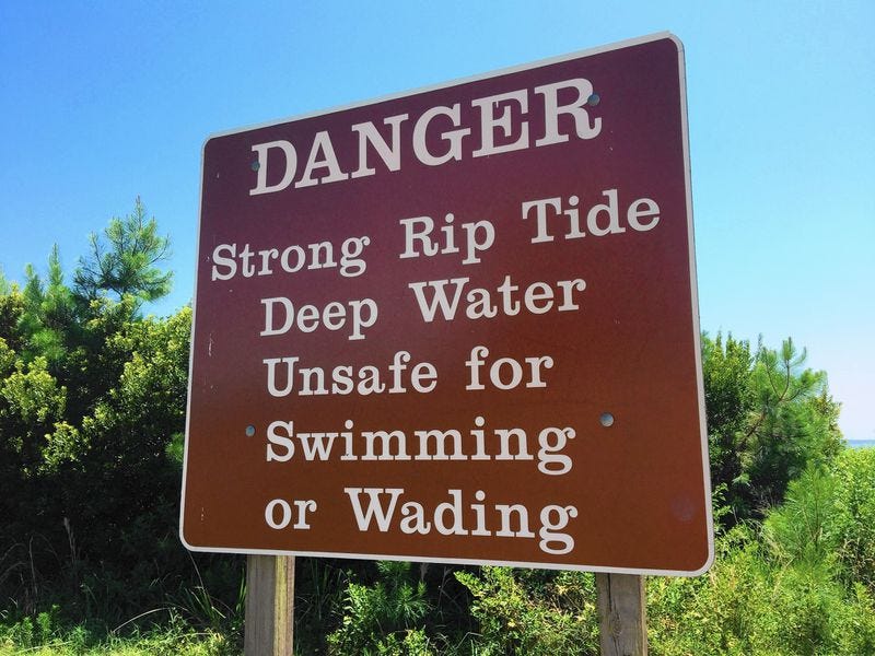
This place is never crowded – the parking lot holds about 20 cars and it is hardly ever more than half full. Couples of all ages stroll hand-in-hand on this narrow beach. Students from the nearby College of William and Mary sprawl on blankets here, “studying.” Families bring their children to swim in the river while the parents either play with them in the shallow water or relax on the riverbank while watching their children play. Because the water is shallow here as far as 100 feet out into the river, people sometimes think that this is a kind of kiddie pool, but the currents can be strong. This sign is at another popular parkway site, College Creek, just a mile away, where the channel is deeper and the river more hazardous.