Bristol County, Massachusetts
Bristol County, Massachusetts

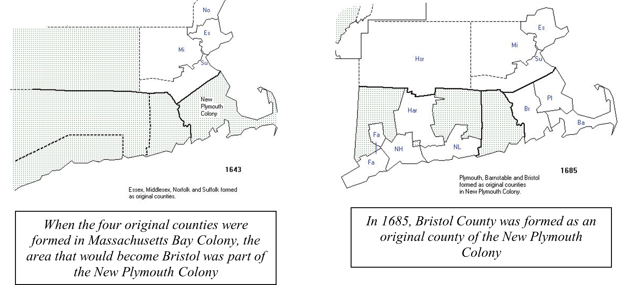
Bristol County, Massachusetts, was one of the three counties formed from New Plymouth Colony in 1685. Prior to that date, the New Plymouth Colony had not been divided into counties. These two maps show the location of New Plymouth Colony before the establishment of the three original counties and the location of the three counties after 1685: (all these maps are taken from https://www.mapofus.org/massachusetts/)
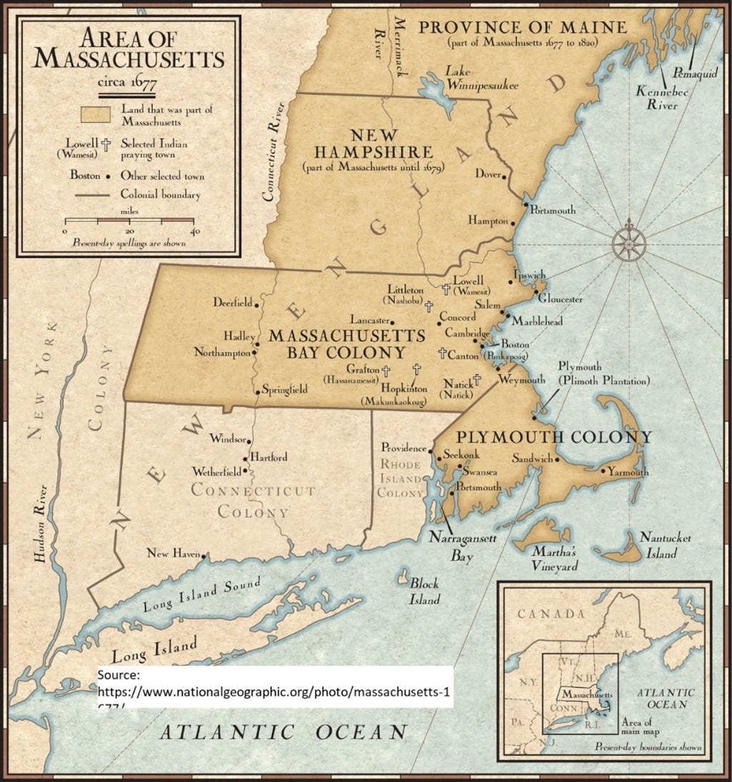
In an earlier essay I wrote about Barnstable County, Massachusetts, and began to remedy the superficiality of my own knowledge of the early settlement of Massachusetts. I knew about the two colonies that made up Massachusetts – Plymouth and Massachusetts Bay – but I hadn’t thought much about the geographical and historical distinctions between them. This map helped me:
This is important knowledge, because it made me realize that researching Bristol County probably means researching the New Plymouth Colony and the towns it encompassed for several decades before turning to records related specifically to Bristol County. Information about my Bristol County ancestors who were living in the towns of Dartmouth, Rehoboth, or Swansea, for example, may be found in the town records as well as in the New Plymouth Colony or Bristol County records.
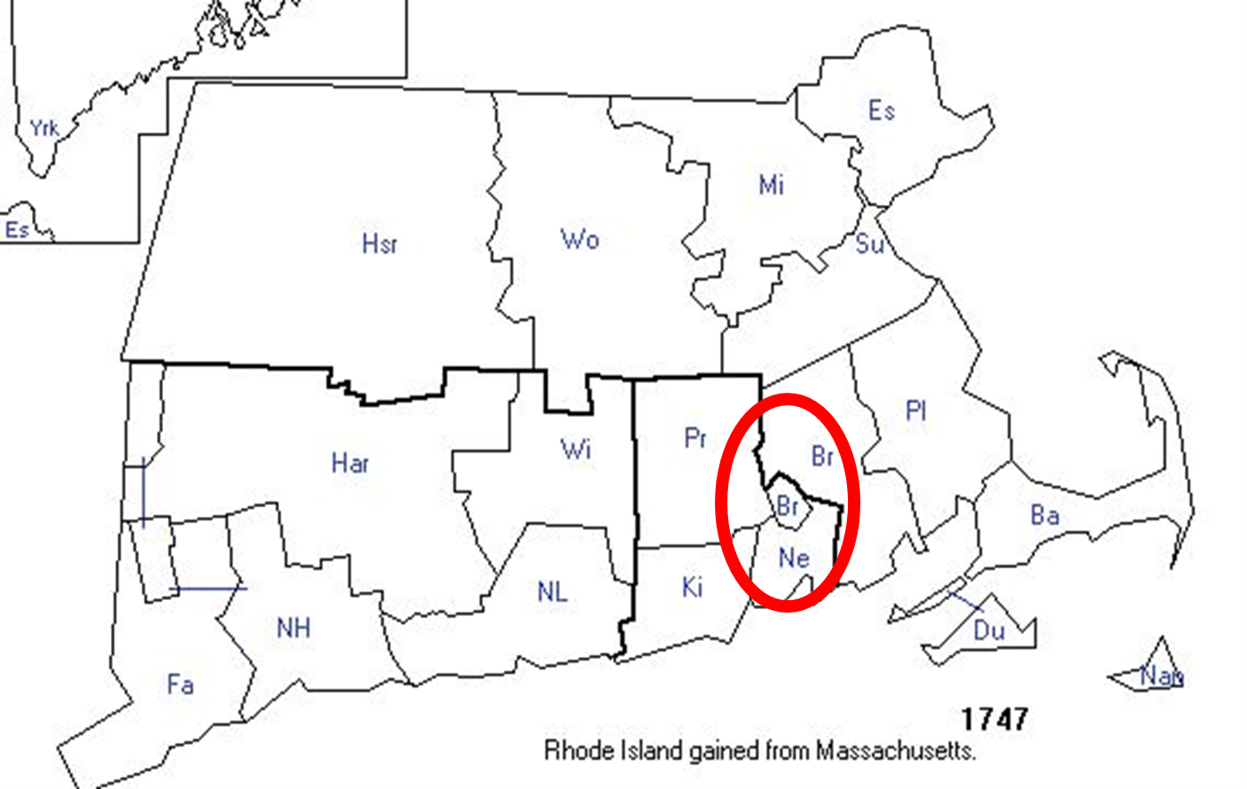
I encountered yet another problem in researching this county; the county seat (the Town of Bristol) was a part of Massachusetts only until 1747, when the British Crown transferred it (along with the towns of Tiverton and Little Compton) to the Rhode Island Colony. Bristol’s desirable location at a good port on Narraganset Bay led the colonies of Massachusetts and Rhode Island to dispute it. The following map illustrates this change; the area circled in red includes the town of Bristol. This means that the county seat of Bristol was moved from the Town of Bristol to the Town of Taunton, about 30 miles northeast of Town of Bristol. This means that the records of early Bristol (before 1747) might be found in the Town of Bristol itself, in Taunton, in Bristol County, or in the New Plymouth Colony (before 1685).
The following pedigree charts provide an overview of the ancestors I’ll be focusing on later in this essay. These ancestors all connect to me through my father’s side of the family. The first pedigree chart shows my Ellefritz family ancestors, and the second shows my Arnold family ancestors. Both sides of my father’s family were in Bristol (and some were in the same towns) 250 years before my grandfather, John Cecil Arnold, married Orpha Lydia Ellefritz in Hancock County, Illinois, in 1916. But first:
A (Very) Little History
According to the FamilySearch Wiki, Bristol County was settled by the Pilgrims who came from older towns Plymouth County. This is borne out by the list of my ancestors who lived in Bristol; among them are the surnames Cooke and Warren, both names of passengers on the Mayflower. The area was at the center of the King Philip's War in 1675/6 and many settlers temporary moved back to the east. The towns in Bristol that are of most interest to me are Dartmouth and Rehoboth, with Dartmouth having by far the largest number of my ancestors living there.
The Town of Dartmouth

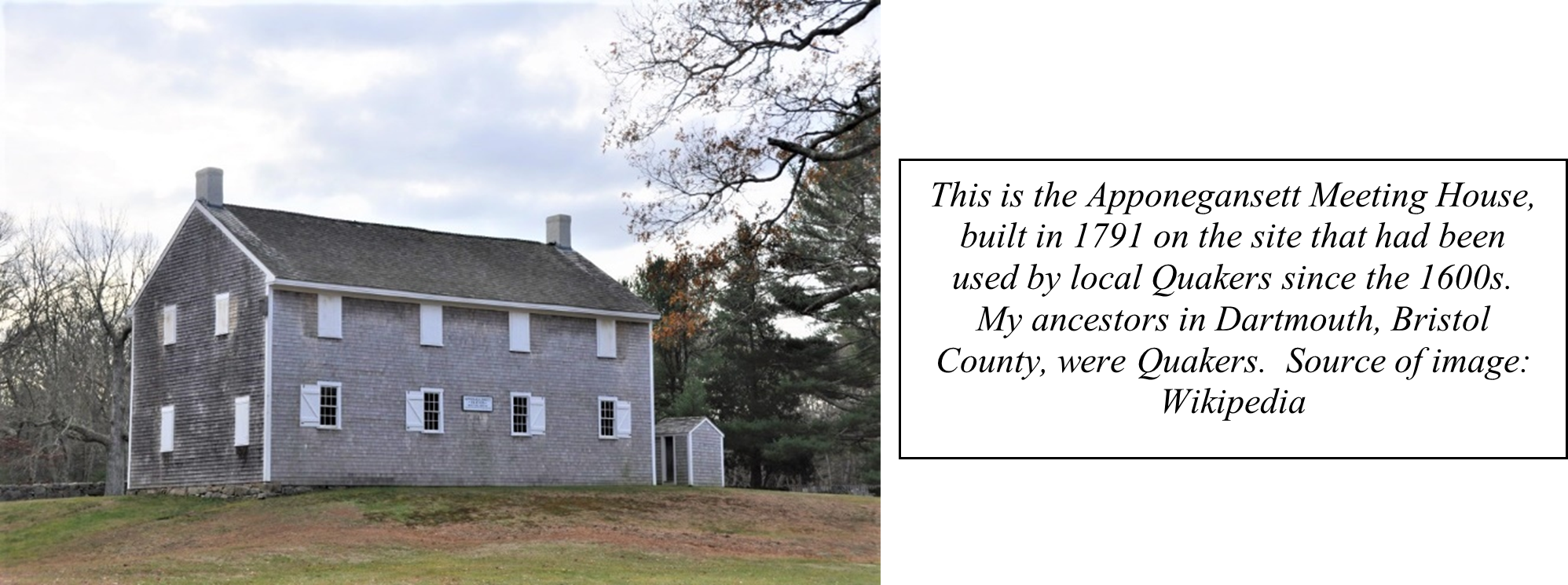
Dartmouth was founded in the early 1650s by Quakers and other dissenters who left Plymouth over doctrinal differences with the church fathers in Plymouth. This is a portion of the deed recording the sale of the property of Dartmouth from the Indians to the white settlers:
"Massasoit and Wamsutta sold to William Bradford, Captain Myles Standish, Thomas Southworth, John Winslow, John Cooke, and their associates, for thirty yards of cloth, eight moose skins, fifteen axes, fifteen hoes, fifteen pairs of breeches, eight blankets, two kettles, one clock, two English Pounds in Wampum, eight pair of shoes, one iron pot, and ten shillings, that land called Dartmouth"
One of these signers is my 9th great-grandfather John Cooke, who arrived on the Mayflower in 1620. I’ll talk more about him later.
According to the website of the town of Dartmouth, in 1664, King Philip (Sagamore of Pokannockett, often called Metacomet or Metacom, who was the son of Massasoit) definitely fixed the bounds of the township and the charter reads as follows:
"Dartmouth made a towne"
At the General Court of Election holden at Plymouth
eighth of June 1664.
"At this court, all that tracte of land commonly called and knowne by the name Acushena, Ponagansett, Coaksett is allowed by the court to bee a townshipe, and the inhabitants thereof haue libertie to make such orders as may conduce to theire common goode in towne concernments and that the said towne bee henceforth called knowne by the name of Dartmouth.”
King Philip (Metacom) would become an important figure in Massachusetts history in the 1670s, as he pursued hostilities against the white settlers in the colony, leading what came to be called “King Philip’s War” in 1675-1676. In this war, towns across New England were destroyed or damaged, and the local economies were essentially ruined.
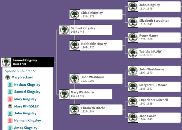
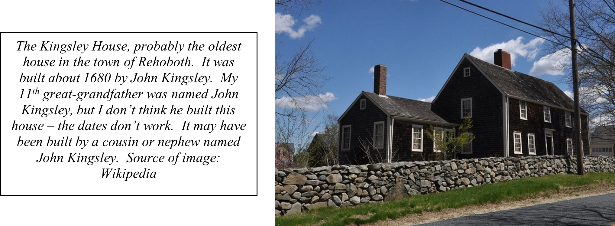
My Ancestors in Dartmouth
The Town of Rehoboth
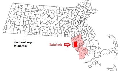
Rehoboth was established in 1643 and was incorporated in 1645. Rehoboth straddles the boundary between Massachusetts and Rhode Island; the early town contained all of what is now Seekonk, Massachusetts, and East Providence, Rhode Island. Rehoboth was a significant site during King Philip’s War. It also claims to be the birthplace of public education in North America – when it was incorporated, residents of the town elected to collect funds to pay a teacher for the children living in the settlement.
My Ancestors in Rehoboth