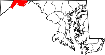
Allegany County, MD (52 Locations in 52 Weeks)
Allegany County, MD (52 Locations in 52 Weeks)

For the next 52 weeks, my Thursday essays about genealogy are going to focus on the counties I wrote about in my 2020 research project, 52 Locations in 52 Weeks. I’ll present them alphabetically, which is the way I wrote them.
NOTE: Allegheny is the early French spelling (as in Allegheny River, which was once part of New France ), and Allegany is closer to the early English spelling (as in Allegany County, Maryland, Allegany County, New York, or Alleghany county, Virginia ).
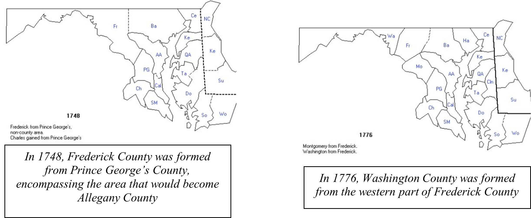
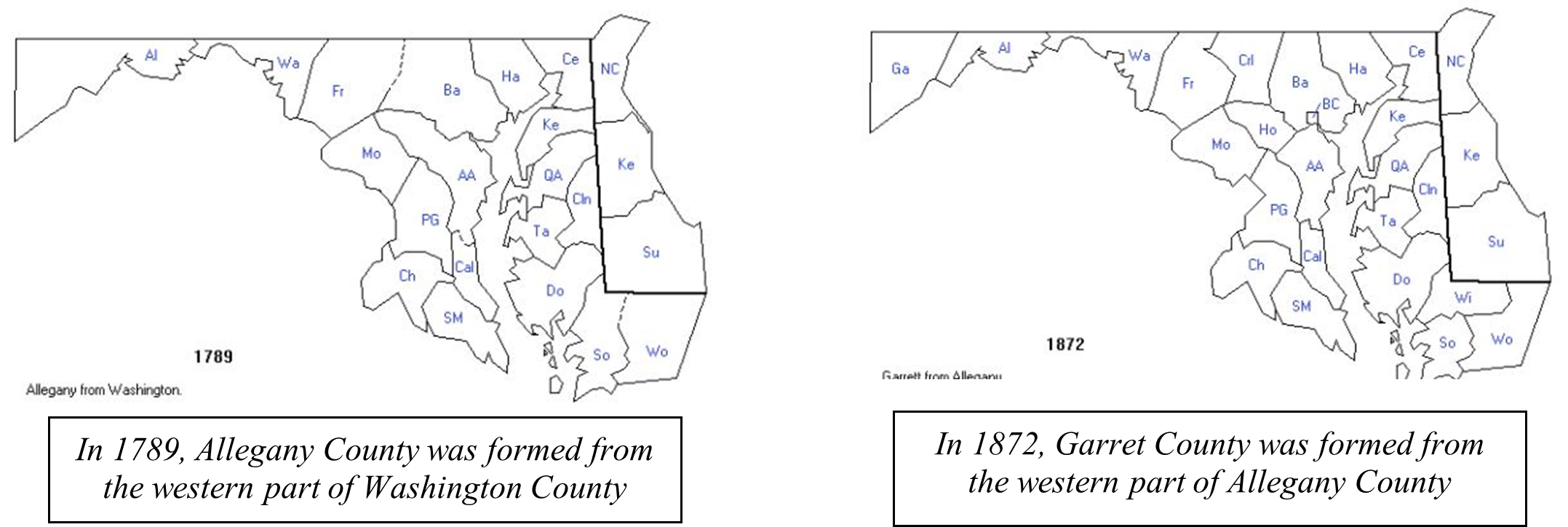
The western part of Maryland (including the present Allegany County) was originally part of Prince George's County when Maryland was formed in 1696. This county included six current counties, and new counties were generated by the repeated splitting of the old ones. Frederick was formed from Prince George's in 1748, and Montgomery and Washington Counties were formed from Frederick in 1776. Allegany County was formed in 1789 by the splitting of Washington County. At that time it was the westernmost county in Maryland, but a split in 1872 produced Garrett County, the current westernmost county.
Evolution of County Boundaries in Maryland
Understanding this process of how county boundaries changed over time is essential to understanding the history of population movements in the area as well as the location of records documenting my ancestors in the area. All these maps are taken from the website https://www.mapofus.org.

A (Very) Little History
The history of Allegany County is bound up with the history of the expansion of colonial interests into the Ohio valley during and after the 1740s. In 1749, Christopher Gist, an agent for the Ohio Company (a land speculation company organized by and for Virginians interested in the Ohio County, the name given to the land north and west of the Ohio River before the American Revolution), built a stockade and trading post at Wills Creek in what would become Allegany County. The company, organized in 1748 by Thomas Lee and brothers Lawrence and Augustine Washington (half-brothers of George Washington), had a land grant from Britain as well as a treaty with the Indians who lived there. France also claimed the area, and this conflict helped provoke the outbreak of the French and Indiana War in 1756.
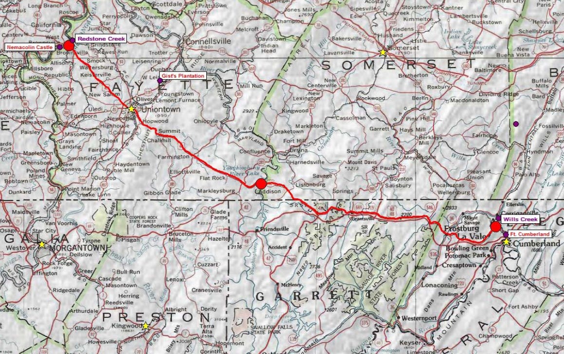
Gist’s Trace (the route explored and documented by Christopher Gist) provided the template for travel between the Potomac River and the Ohio River; this was the route followed a few years later by the ill-fated expedition against the French led by General Braddock (accompanied by the young George Washington). Fort Cumberland was built where Wills Creek empties into the Potomac River; this fort served as an outpost for George Washington during the French and Indian War, and it was the location of his first military headquarters. The city of Cumberland is the county seat of Allegany County.
My Ancestors in Allegany County
My ancestors did not spend much time in Allegany County – only around 35 years. They arrived there sometime around 1779 and were gone by 1815. But their presence in the county links me to an adventurous time in my family history, and I want to tell this story.